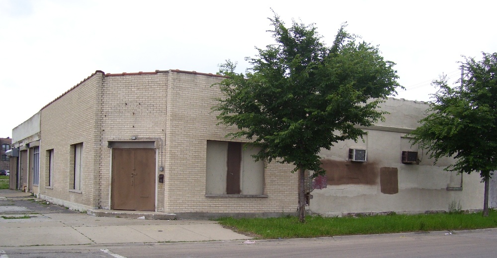
Any real estate agent or Realtor can tell you that the three most important factors in determining the potential value of a particular parcel of real estate are, in order: location, location, location. Location can trump other aspects of a structure, including whether it is occupied and its state of (dis)repair. In fact, location plays a large role in determining whether a decrepit building is worthy of the financial investment necessary to reclaim it for productive use, assuming of course that it is structurally sound.
Hidden Value in Vacant and Abandoned Buildings
A rudimentary tool called Hidden Value in Abandoned Buildings (HViAB) applies the concept of location and property value to vacant and abandoned buildings. HViAB, created during the CNT 2012 Reinventing Chicago Hackathon.matches vacant and abandoned buildings with amenities located within a half mile radius. The matching process uses latitude and longitude to calculate distance between each property and a database of amenities, and displays the results on a Google Map. The tool utilizes data from the Vacant and Abandoned Buildings Finder compiled by Derek Eder as well as data from the Center for Neighborhood Technology (CNT) H+T Affordability Index which calculates the affordability of particular areas based on both housing and transportation. The database of resources and amenities was compiled from research I conducted during the Hackathon.
HViAB was a collaborative effort between myself and programmer Daniel Fehrenbach of Elevate Energy. I first had the idea for something like HViAB while preparing a presentation for the 2012 Chicago Green Festival. I was struck by the irony of residential and commercial structures standing empty while families were being forced out of their homes through foreclosure and eviction. I was and remain convinced that there should be a way to promote the rehabilitation or restoration of at least some of empty properties for affordable housing. My hope is eventually to refine and build out the tool so that it can be utilized in promoting affordable housing and sustainable development, first in Chicago but ultimately wherever vacant and abandoned properties are located.
Location, Location, Location
A casual glance at the photo above reveals only a structure that is obviously vacant and perhaps even abandoned. Its nondescript appearance provides few clues about what its former function may have been or its potential value for future use. What you cannot see in the photo of the dilapidated structure pictured at the beginning of this post is that it is located literally across the street from Shops and Lofts on 47. This mixed-use development is presently under construction on the economically prominent 47th Street corridor in Bronzeville, located on Chicago’s Near South Side. This development, designed to be an economic anchor for the community, includes commercial and retail establishments, parking and residential units.
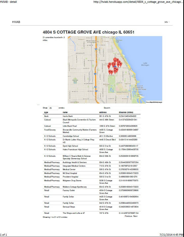
The graphic shown here is a visual representation of what the nondescript structure shown above looks like on a screenshot taken from the HViAB tool. In addition to being situated within sight of Shops and Lofts on 47, this vacant building is located in close proximity to retail, educational and cultural amenities. What the graphic doesn’t show is that this building is also located steps away from the 47th Street Chicago Transit Authority (CTA) Green Line station. Suddenly, the nondescript structure in the photo looks very desirable for potential redevelopment – in large part due to its location, or rather, its proximity to a significant community development and convenient public transportation, not so much from the empty building itself.
Drive Less, Walk More
Considering a somewhat more nuanced meaning to the concept of location is an essential step to unlocking the “hidden” value of a building and was a guiding principle behind the development of HViAB. HViAB provides a visual representation of what real estate agents consider the most important aspect of a prospective property listing: location. A tool like HViAB can be used by planners, developers, architects, municipalities and community-based organizations to identify locations where vacant and abandoned properties are located near a sufficient concentration of amenities to justify a larger investment to rehab, restore or retrofit the property than the actual structure may seem to merit at first glance.
Of course, location is not the only measure of a building’s value. A major variable in determining the “hidden” value of a vacant or abandoned building is defining what constitutes an amenity. As it turns out, the answer often depends on the community or location involved. Nonetheless, a credible case could be made that a large factor in the appeal of particular amenities is associated with proximity and accessibility, especially for people who cannot afford or choose not to own cars. According to CNT, transportation costs are the second largest single expenditure for households across the United States. One use that I envision for HViAB is to encourage the rehabilitation and redevelopment of close-in vacant and abandoned properties like the one in the photo above that allow individuals and families to reduce or even eliminate the need to own cars.
It’s Not Easy Being Green
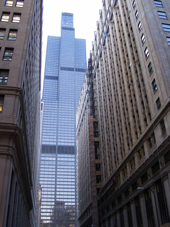
Whenever possible, rehabbing or retrofitting an existing structure imposes less adverse environmental impact than new construction. As the truism goes: the most environmentally friendly building is the one that is already standing. Such buildings have embodied much of their carbon footprint already. This truism even applies to Modernist temples of steel and glass, many of which were constructed during the mid-20th Century when environmental issues or energy efficiency were often not considered in building design, even as an afterthought.
Skyscrapers of every era also add richness and variation to the urban fabric, especially in Chicago, a city which is internationally renowned for its spectacular architecture. It is relatively easy to justify spending the financial resources and labor to implement energy efficient rehab and retrofitting strategies in maintaining architectural icons. One such initiative is presently underway at the former Sears Tower, now known as Willis Tower, which was the tallest building in the world when it was constructed in 1975. The original windows in Willis Tower have been replaced with energy-efficient windows, and an experimental green roof has been constructed on the 90th floor of the supertall structure.
On the other hand, rallying the finances to employ green rehabilitation for structures that lack iconic value, such as the dilapidated structure pictured at the beginning of this post often prove to be a challenge, environmental concerns aside. Location can play a key role a key role in addressing such challenges. HViAB or a similar tool can be useful in making a case for justifying the upfront investment necessary to incorporate sustainable building and development practices to pedestrian buildings, including sustainable materials and construction methods, energy-efficient double or triple paned windows and other measures required to adhere to stringent sustainability standards such as LEED (Leadership in Energy and Environmental Design) or even stricter measures, including Passive House or the Living Building Challenge.
Warmth from Different Suns

The greater Bronzeville area, located on Chicago’s Near South Side, is the ideal location for the prototype of a tool like HViAB, due to its rich history, ample cultural resources, advantageous location near downtown and Lake Michigan – and its abundance of vacant and abandoned properties. Many black sharecroppers who fled the South for the North during the Great Migration landed in Bronzeville. In addition, several prominent African American figures such as writer Lorraine Hansberry and President Barack Obama either lived in Bronzeville or presently call the area home.
Nonetheless, like many areas largely populated by lower income residents and people of color, several neighborhoods within Bronzeville were hard hit by the recession and the foreclosure crisis. As a result, thousands of properties in Bronzeville stand vacant. One local initiative, the Cook County Land Bank Authority, has been tasked with acquiring and redeveloping vacant and abandoned properties in and around Chicago for residential and commercial development in an effort to stabilize hard-hit neighborhoods like Bronzeville.
But Bronzeville is also graced with an active network of community and cultural organizations. Community and cultural organizations throughout Bronzeville are actively engaged in several projects designed to promote Bronzeville and celebrate the upcoming centennial of the Great Migration in 2016. In particular, the Black Metropolis National Heritage Area Commission has collaborated with the Chicago Metropolitan Agency for Planning to create a feasibility study to consider how to develop Bronzeville as a cultural tourist destination for domestic and international travelers.
Hail to the Chief?
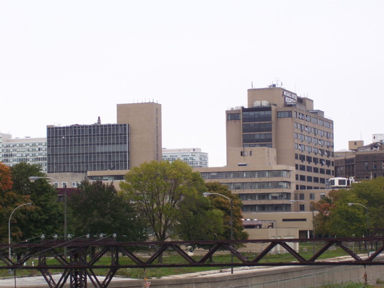
One of Bronzeville’s highest ambitions is to score the Barack Obama Presidential Library and Museum. Bronzeville’s ambitious bid, with designs by architecture firm HOK is located on the site of the former Michael Reese Hospital. Formerly slated for the location of the Olympic Village as part of Chicago’s failed bid for the 2016 Summer Olympic Games, the bid calls for developing a park to link the complex to Lake Michigan.
Despite a stated desire from Mayor Rahm Emanuel for a single Chicago bid for the presidential library, several competing bids were submitted from sites within the city, including bids from the University of Chicago, the University of Illinois at Chicago, Chicago State University and a bid utilizing the old U.S. Steel site on the far South Side.There are even two out-of-state bids for the presidential library, one each from Obama’s birth state of Hawaii and from New York City, where Obama attended Columbia University as an undergraduate.
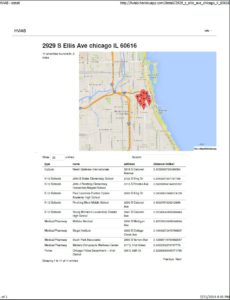
The nearly vacant Michael Reese campus nonetheless enjoys close proximity to McCormick Place, one of the country’s premier convention and exhibition spaces. The Bronzeville site is also within walking distance of the 27th Street Metra Electric station and the 22nd Street CTA Green Line station, presently under construction. This screenshot from HViAB also reveals that the location is close to several schools and a police station, which could also work to its advantage. Even if it is not selected for the Obama library, the Michael Reese campus is ideally located for other commercial, residential, cultural or mixed use developments.
Next Steps
One of the most advantageous aspects of a tool like HViAB is its versatility and scalability. The databases of vacant and abandoned properties and of amenities and resources can be adapted to nearly any populated location and expanded to accommodate as many data points as needed. Categories can also be added to sort the data according to the priorities of a particular location.
Since the initial development of HViAB, I have made several presentations to organizations across Chicago. Besides explaining and demonstrating the tool, I have solicited and received several constructive suggestions which I would like to incorporate into later versions, including adding crime data. Plans to make the tool more attractive and user-friendly include refining the interface and including a more intuitive menu. I would also like to update the database of vacant and abandoned properties and build out a more complete database of amenities and resources. In the meantime, the prototype remains functional and available online. I am also readily available to respond to questions about the tool and to consider suggestions for further improvements.
Isn’t land value the gold standard, or at least the first step towards determining locational value? Once that is determined by a responsible appraiser, then these variables, especially reuse value would be a less complicated affair.
Hello Joshua. Thank you for your thoughtful comment.
Land value is certainly a relevant standard, and even a prominent standard. But I would offer that land value is significantly impacted by its location, especially in the built environment. For instance, a patch of land in the middle of nowhere with nothing around it *may* be valuable to a farmer, assuming that the soil is fertile and well-irrigated. But the same parcel of land would likely have much less value to a commercial developer or for a nonprofit agency seeking to create affordable housing or viable small businesses. I actually sense that we may both be referring to the same concept, but approaching it from different perspectives.